Our thoughts are with you all.
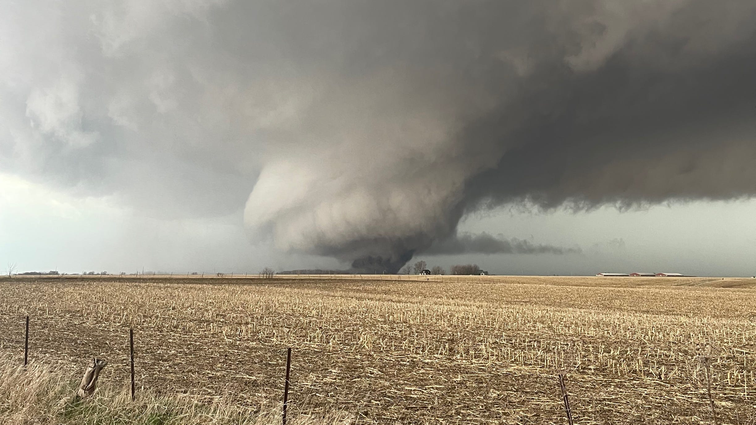
The tornado ploughed through Little Rock and surrounding areas, reducing rooftops to splinters, toppling vehicles and tossing debris on roadways as people raced for shelter.
More than 350,000 people were at risk as what the National Weather Service called a “confirmed large and destructive tornado” tore through business districts and neighbourhoods in Little Rock and North Little Rock.
The Little Rock Fire Department reported heavy damage and debris in the western end of the city. Firefighters were performing rescue operations in the area, the department said on its social media page. Other details are not available at present...
Passengers and airport employees at Clinton National Airport in Little Rock took shelter in bathrooms and were ordered to stay there until 3.45pm. Aerial footage showed several rooftops were torn from homes in Little Rock and nearby Benton.
Nearly 70,000 customers in Arkansas were out of power on Friday afternoon, according to poweroutage.us, which tracks outages.
About 32,000 were without power in neighbouring Oklahoma, where wind gusts between 50 and 60 miles per hour fueled fast-moving grass fires. People were urged to evacuate homes in far northeast Oklahoma City, and troopers shut down portions of Interstate 35 near the suburb of Edmond.
More outages were reported in Kansas, Missouri and Texas.
Massive storms brewing over at least 15 states in the Midwest and southern US on Friday have meteorologists urging people to brace for dangerous weather, including tornadoes, saying the conditions are similar to those a week ago which unleashed a devastating twister that killed at least 21 people in Mississippi.
More than 85 million people were under weather adviseries on Friday as the National Weather Service’s Storm Prediction Center forecast an unusually large outbreak of thunderstorms with the potential to cause hail, damaging wind gusts and strong tornadoes that could move long distances over the ground.
The area at greatest risk for storms on Friday follows a large stretch of the Mississippi River from Wisconsin to Mississippi, with rare high-risk adviseries centred around Memphis and between Davenport, Iowa and Quincy, Illinois and surrounding areas.
Forecasters issued tornado watches over both high-risk regions until Friday evening, with the weather service expecting numerous tornadoes and calling it a “particularly dangerous situation”.
All told, by Friday afternoon, tornado watches issued by the National Weather Service cover most of Missouri, Arkansas and Iowa, western Illinois, and parts of Wisconsin, Texas, Tennessee, Kentucky, Louisiana, Oklahoma and Mississippi. Tornado warnings were issued for isolated areas of Arkansas, Missouri and Illinois on Friday afternoon.
Also on Friday, parts of Texas, Oklahoma, New Mexico and Kansas were at risk for widespread fires due to dry conditions, high winds and warm temperatures, the weather service said....
The “intense supercell thunderstorms” predicted for Friday afternoon are only expected to become more common, especially in southern states.
Apart from Little Rock, the major population centres at high risk for storms, starting on Friday afternoon, include Chicago; St. Louis; Jonesboro, Arkansas; and Des Moines and Cedar Rapids, Iowa...
There will be lots of thunderstorms ... tornadoes, damaging winds, and large hail,” said Northern Illinois meteorology professor and tornado expert, Victor Gensini.
People in those areas should stock emergency supplies, prepare for power outages, avoid getting stranded in places vulnerable to falling trees or severe hail and park vehicles in garages if possible, meteorologists said.
Forecasters warned of a “relatively rare, significant severe weather threat” around Chicago that could include powerful winds, tornadoes and large hail.
In Iowa City, the University of Iowa cancelled Friday’s watch party for fans who planned to gather for the women’s basketball Final Four game against South Carolina. Deputy director of athletics Matt Henderson said in a statement the decision was made “due to the unpredictable timing of possible severe weather and potential storm impact”.
Godspeed


